I found these two historical maps today while digging around for some locality information for Algonquin, Illinois. Maps have always fascinated me and they are particularly interesting when you can compare one place across time.

1818 Geographical, Statistical, and Historical Map of Illinois

1833 Map of Illinois
This is a collection of plot maps for McHenry County, Illinois. I believe it is for various years, though it is not the most image friendly website.
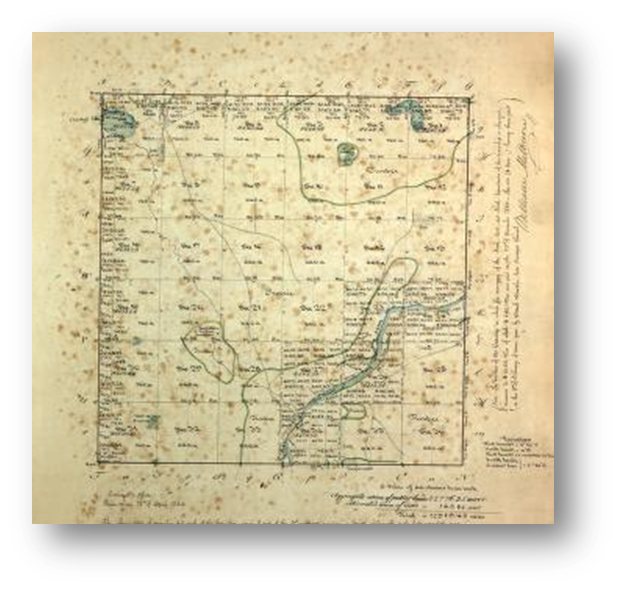
Above is a screen shot of the Algonquin Twp plot map. You will need to use the above link (or click on picture then Algonquin) to be able to read anything on the map which includes interesting information about the survey.
Several more historic Illinois maps from 1835-1885 can be found HERE
No comments:
Post a Comment